Leading the Way in Aerial Forestry Solutions
Community Engagement Programs
Community Engagement Programs
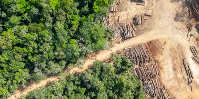
At Dirt Aerial Precision, we utilize innovative mapping techniques to provide detailed forest surveys. Our aerial data helps identify critical areas for management, ensuring that forestry practices are informed and effective. With our technology, clients can achieve their sustainability goals.
Community Engagement Programs
Community Engagement Programs
Community Engagement Programs
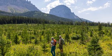
Engaging local communities in forestry efforts is vital for long-term success. Dirt Aerial Precision offers programs designed to educate and involve community members in sustainable practices. By fostering collaboration, we contribute to healthier forests and stronger community ties.
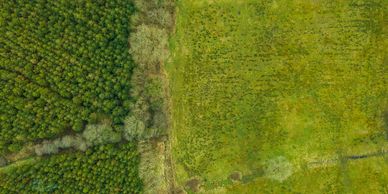
Climate Change Impact Studies
Community Engagement Programs
Understanding the impact of climate change on forests is essential for effective management. Dirt Aerial Precision conducts aerial studies to assess how climate factors affect forest health. Our research supports adaptation strategies that help forests thrive in changing conditions.
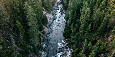
Biodiversity Assessment Services
Biodiversity is crucial for resilient ecosystems. Dirt Aerial Precision provides aerial assessments to evaluate species diversity within forests. Our insights help land managers make informed decisions that protect wildlife and promote ecological balance.
Data-Driven Decision Making
Data-Driven Decision Making
Data is key to effective forestry management. At Dirt Aerial Precision, we provide data-driven insights through our aerial services, enabling clients to make informed decisions. Our analytics support sustainable practices and enhance operational efficiency in forestry management.